-
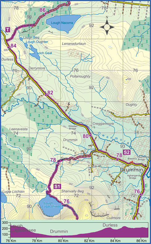
The Western Way
Vendor:East West MappingRegular price €9.00Regular priceUnit price per -
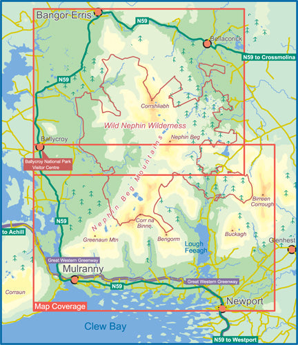
Wild Nephin Folded
Vendor:East West MappingRegular price €10.50Regular priceUnit price per -
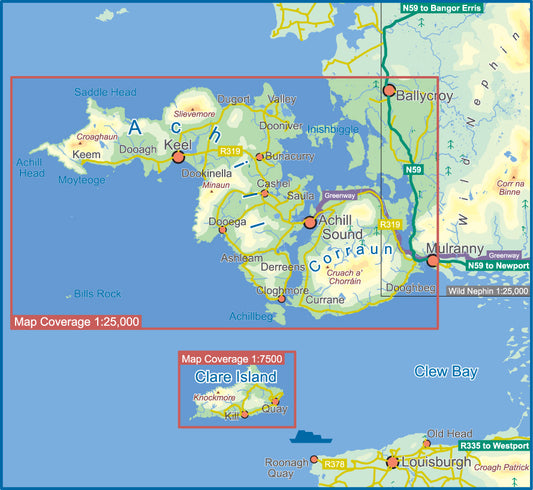
Achill & Corraun ~ Clare Island
Vendor:East West MappingRegular price €14.40Regular priceUnit price per -
Connemara Mountains
Vendor:East West MappingRegular price From €14.40Regular priceUnit price per -
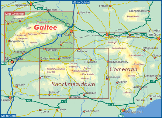
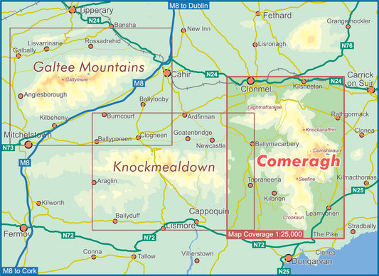
Knockmealdown
Vendor:East West MappingRegular price From €14.40Regular priceUnit price per -
Táin Way Map Guide
Vendor:East West MappingRegular price €6.00Regular priceUnit price per -
The Wicklow Way - Clonegal to Dublin
Vendor:East West MappingRegular price €9.00Regular priceUnit price per -
The Wicklow Way
Vendor:East West MappingRegular price €9.00Regular priceUnit price per -
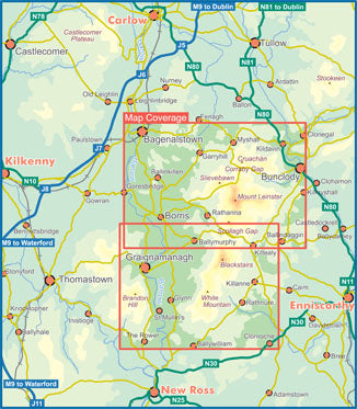
Blackstairs, Mount Leinster & The Barrow Valley
Vendor:East West MappingRegular price €10.50Regular priceUnit price per -
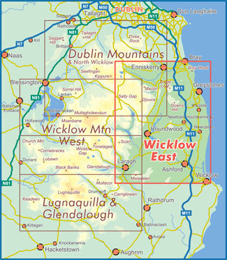
Wicklow East
Vendor:East West MappingRegular price From €14.40Regular priceUnit price per -
Wicklow West
Vendor:East West MappingRegular price From €14.40Regular priceUnit price per -
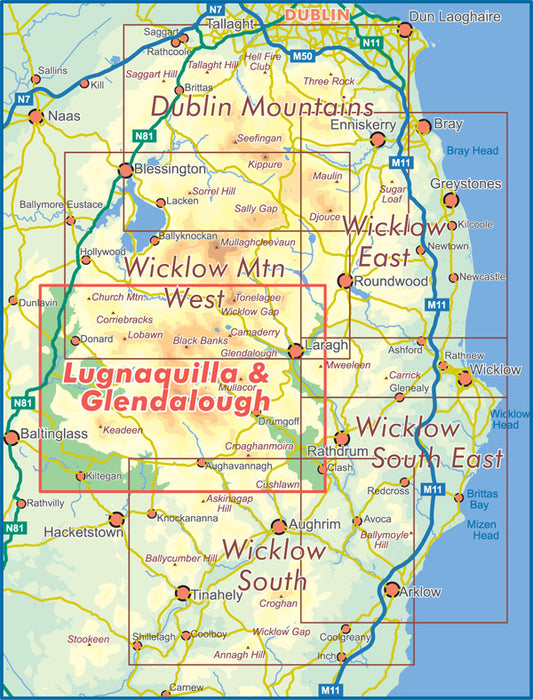
Dublin Mountains
Vendor:East West MappingRegular price From €14.40Regular priceUnit price per -
Lugnaquilla & Glendalough
Vendor:East West MappingRegular price From €14.40Regular priceUnit price per -
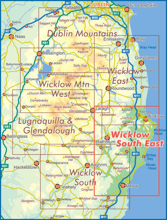
Wicklow South East Paper
Vendor:East West MappingRegular price From €14.40Regular priceUnit price per -
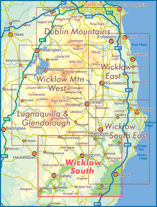
Wicklow South Paper
Vendor:East West MappingRegular price From €14.40Regular priceUnit price per