1
/
of
1
Harvey
Ben Venue
Ben Venue
Regular price
€13.57
Regular price
Sale price
€13.57
Unit price
/
per
Taxes included.
Shipping calculated at checkout.
Couldn't load pickup availability
Description
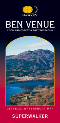
Includes Loch Ard Forest, Ben Venue and the Menteith Hills. Detailed map for hillwalkers of the south eastern part of the Loch Lomond and Trossachs National Park at the popular scale of 1:25,000. This sheet provides an excellent mountain bike map of Loch Ard Forest. Trails are shown on the map.
Features
- Waterproof
- Genuine, original, HARVEY mapping
Technical Information
- Scale: 1:25,000
- Ratio: 4cm = 1km
- Flat size: 972 x 700mm
- Folded size: 116 x 243mm
- Weight: 94gms
- Area of mapping: 293sqkm
- Single sided
Share


