1
/
of
1
Harvey
Cadair Idris
Cadair Idris
Regular price
€13.57
Regular price
Sale price
€13.57
Unit price
/
per
Taxes included.
Shipping calculated at checkout.
Couldn't load pickup availability
Description
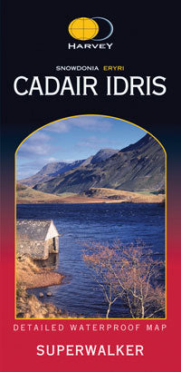
Cadair Idris, one of the most popular mountains in Wales, consists of a long ridge. Its northern face is craggy and precipitous, in contrast to the south face which slopes more gently into the broad expanse of the Dyfi estuary.
Detailed map for hillwalkers of the southern part of the Snowdonia National Park at the popular scale of 1:25,000.
Welsh-English text.
Features
- Waterproof
- Genuine, original, HARVEY mapping
- Includes Rights of Way
Technical Specification
- Scale: 1:25,000
- Ratio: 4cm = 1km
- Flat size: 972 x 700mm
- Folded size: 116 x 243mm
- Weight: 94gms
- Area of mapping: 334sqkm
- Single sided
Share


