1
/
of
1
Harvey
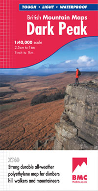
Dark Peak (British Mountain Map)
Dark Peak (British Mountain Map)
Regular price
€20.65
Regular price
Sale price
€20.65
Unit price
/
per
Taxes included.
Shipping calculated at checkout.
Couldn't load pickup availability
Description
"The 1:40,000 scale used by British Mountain Maps is excellent for hill walking. These maps provide clear, detailed information." Sir Chris Bonington, mountaineer.
Detailed map of the Dark Peak’s famous Moorland Hills and Edges on a single sheet at 1:40,000 scale.
Detailed enlargement of the Kinder plateau. Map extension to Marsden.
As used by Woodhead Mountain Rescue Team.
Features
- Tough, light, durable and 100% waterproof
- Genuine original HARVEY mapping
- Includes Rights of Way
- Tried and tested by the British Mountaineering Council
Technical Specification
- Scale: 1:40,000
- Ratio: 2.5cm = 1km
- Flat size: 992 x 940mm
- Folded size: 124 x 235mm
- Weight: 90gms
- Area of mapping: 1122sqkm
- Double sided
Share


