1
/
of
1
Harvey
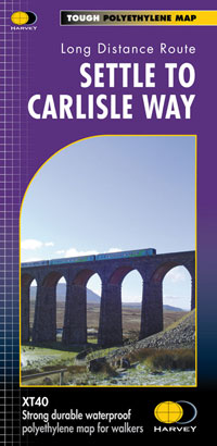
Settle to Carlisle XT40
Settle to Carlisle XT40
Regular price
€17.95
Regular price
Sale price
€17.95
Unit price
/
per
Taxes included.
Shipping calculated at checkout.
Couldn't load pickup availability
Description
Entire route on one map
Settle Carlisle Way is a 154km (96 miles) walking route linking the stations of the famous and scenic Settle-Carlisle Railway Line. This map gives you the chance to walk up and ride back on the train, or to hop off at one station and re-join a later train further on.
The route starts in picturesque Settle and passes through the beautiful Yorkshire Dales and the sheltered Eden Valley, ending in central Carlisle.
Features
- Tough, light, durable and 100% waterproof
- Includes Rights of Way
- Genuine original HARVEY mapping
- Route clearly marked
Technical Specification
- Scale: 1:40,000
- Ratio: 2.5cm = 1km
- Flat size: 972 x 700mm
- Folded size: 116 x 243mm
- Weight: 60gms
- Double sided
- Format: strip map
Share


