1
/
of
1
Harvey
White Peak (British Mountain Map)
White Peak (British Mountain Map)
Regular price
€20.65
Regular price
Sale price
€20.65
Unit price
/
per
Taxes included.
Shipping calculated at checkout.
Couldn't load pickup availability
Description
"British Mountain Maps are fit for purpose with great cartography, full of relevant information and include a geological map. Imagine a completely waterproof map that is lighter than paper and will remain reliable in any conditions. This is it." Mark Vallance, founder of Wild Country.
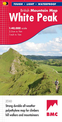
The hills and dales of the White Peak on a single map at 1:40,000 scale.
Features
- Tough, light, durable and 100% waterproof
- Genuine original HARVEY mapping
- Includes Rights of Way
- Tried and tested by the British Mountaineering Council
Technical Specification
- Scale: 1:40,000
- Ratio: 2.5cm = 1km
- Flat size: 992 x 940mm
- Folded size: 124 x 235mm
- Weight: 90gms
- Area of mapping: 1199sqkm
- Double sided
Share


